In this article:
- What the Kumano Kodo Is
- Choosing a Route
- Stamps, Certificates, and the Dual Pilgrim
- Inns, Luggage, and Hot Springs
- Preparation and Season
- Kumano Kodo Trail: Frequently Asked Questions
Introduction
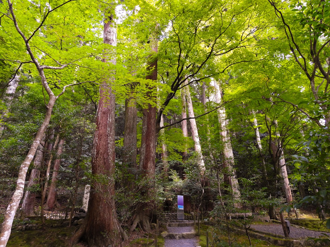
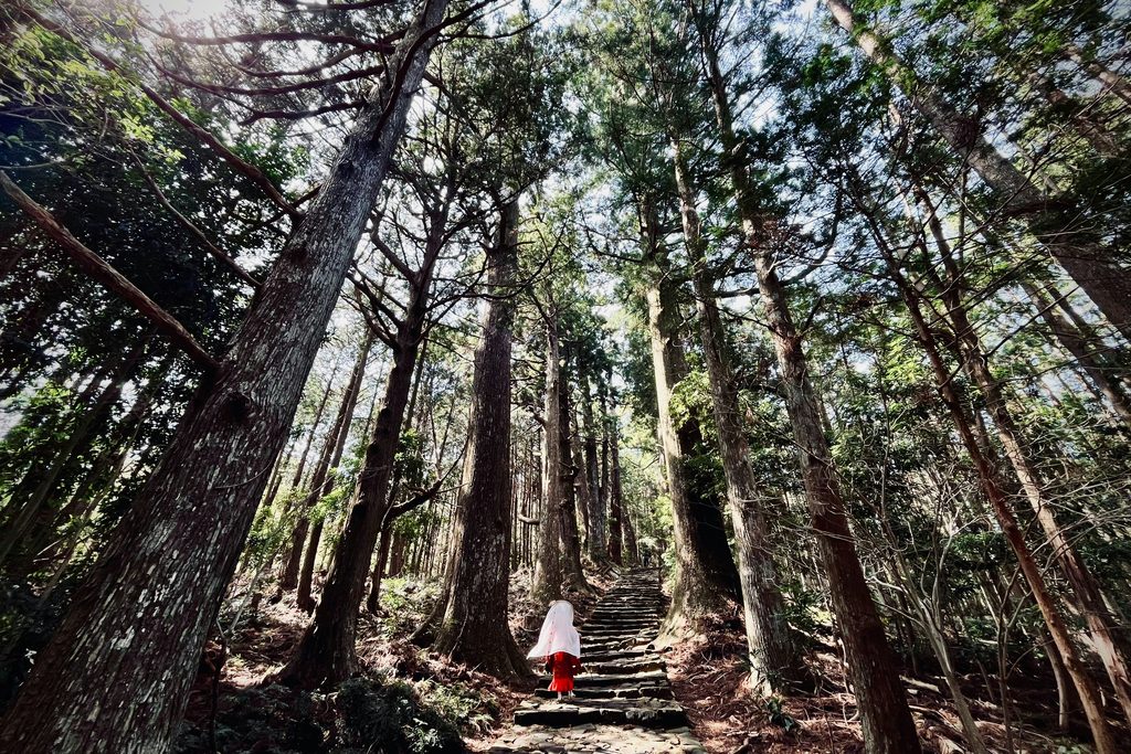
The cedar forest on the Nakahechi absorbs sound in a way that takes about an hour to notice. There is no traffic, no other party ahead of you, and the loudest thing is your own boots on wet stone.
This is the oldest continuously walked pilgrimage route in Japan, used by retired emperors, ascetics, and eventually ordinary people since the Heian period. What survives is not a monument but a path — stone steps laid by hand, small roadside shrines at intervals, and villages where the inn has been taking in walkers for generations.
We send more travelers here than to any other multi-day walk in Japan, and almost none of them expected it to be as quiet as it is. The Camino de Santiago sees hundreds of thousands of walkers a year. The Kumano Kodo sees a fraction of that, and much of it in two short seasons.
What the Kumano Kodo Is
Not one trail but several, converging on three shrines in the mountains of the Kii Peninsula, south of Osaka.
A World Heritage Route
The routes were inscribed by UNESCO in 2004 as part of the Sacred Sites and Pilgrimage Routes in the Kii Mountain Range, alongside Koyasan and Yoshino.
Pilgrimage routes almost never receive this designation. The Camino de Santiago is the only other one, which is why the two have a formal relationship that matters later in this article.
The listing covers the paths themselves as well as the shrines, which is unusual and reflects the fact that on the Kumano Kodo the walking is the point. Arriving by bus at Hongu is a different experience from arriving on foot, and everyone who has done both says so.
Who Walked It, and Why
The peak was the eleventh and twelfth centuries, when retired emperors made the journey from Kyoto repeatedly — a round trip of a month or more, with an entourage of several hundred.
The draw was syncretic. Kumano’s shrines were understood as places where Shinto deities and Buddhist figures were the same beings under different names, which made the pilgrimage available to anyone regardless of sect, class, or gender. That last point mattered enormously in medieval Japan, where most sacred mountains were closed to women. Kumano was not.
The phrase used at the time was that the route saw “ants’ processions” — a continuous line of pilgrims. You will not see that now.
The Three Grand Shrines
Kumano Hongu Taisha sits inland, and is where most walking routes converge. The shrine stands on a hill; its original site on the riverbank below, Oyunohara, is marked by a steel torii gate 33.9 metres high, the largest in the world. Walking under it at dusk with the river behind you is the single strongest moment on the route.
Kumano Hayatama Taisha is at Shingu on the coast, at the mouth of the Kumano River, vermilion and compact.
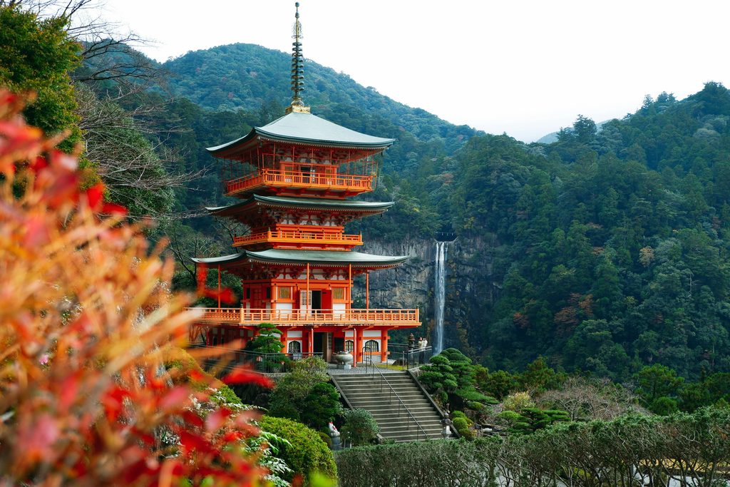
Kumano Nachi Taisha sits above Nachi Falls, a single 133-metre drop that is the tallest of its kind in Japan. The pagoda-and-waterfall view here is one of the most photographed compositions in the country, and it is genuinely better in person, in rain, with nobody else on the Daimon-zaka steps below.
Expert Tip
The pilgrimage historically ended not at a shrine but at Yunomine Onsen, where pilgrims performed a purification rite in the Tsuboyu bath before completing the route. Tsuboyu is a two-person wooden tub in a hut over a stream, booked in thirty-minute slots for a few hundred yen, and it is the only bath in the world with World Heritage status. Almost every walker passes through Yunomine and a surprising number never book it. Do.
Choosing a Route
Four main routes exist. For a first visit, one of them is right and the other three are not.
Nakahechi: The Default, and the Right One
The Nakahechi runs west to east from Takijiri-oji, near Kii-Tanabe on the coast, inland to Hongu. It is the imperial route, the best maintained, the best signed in English, and the one with a functioning chain of village inns spaced at walkable intervals.
The core section is two days: Takijiri to Chikatsuyu, then Chikatsuyu to Hongu. Extending to Nachi and Shingu makes it four to five days and completes all three shrines.
Daily distances run 13 to 25 kilometres with significant elevation change. This is not a flat riverside walk — the first climb out of Takijiri gains around 300 metres in the first hour, and it is the moment most walkers recalibrate their expectations.
Kohechi: For Experienced Walkers Only
The Kohechi runs south from Koyasan to Hongu, about 70 kilometres over four days, crossing three passes above 1,000 metres.
It is remote, steep, and lightly served by accommodation. Sections have no mobile signal, no shops, and no bail-out point. We recommend it only to people who walk seriously at home and are comfortable with a long day in mountains without support.
Linking Koyasan to Kumano on foot is a genuinely beautiful idea and the route delivers on it. Do the Nakahechi first.
Ohechi and Iseji
The Ohechi follows the coast southward from Tanabe toward Nachi, mixing sea views with road walking. Long stretches run alongside modern roads, which changes the character considerably.
The Iseji approaches from Ise on the eastern side of the peninsula, with beautiful stone-paved passes and much less infrastructure for foreign walkers.
Both are worthwhile for a second visit. Neither is where to start.
Stamps, Certificates, and the Dual Pilgrim
There is a formal record-keeping system, and it is more engaging than it sounds.
Oji Shrines and the Stamp Book
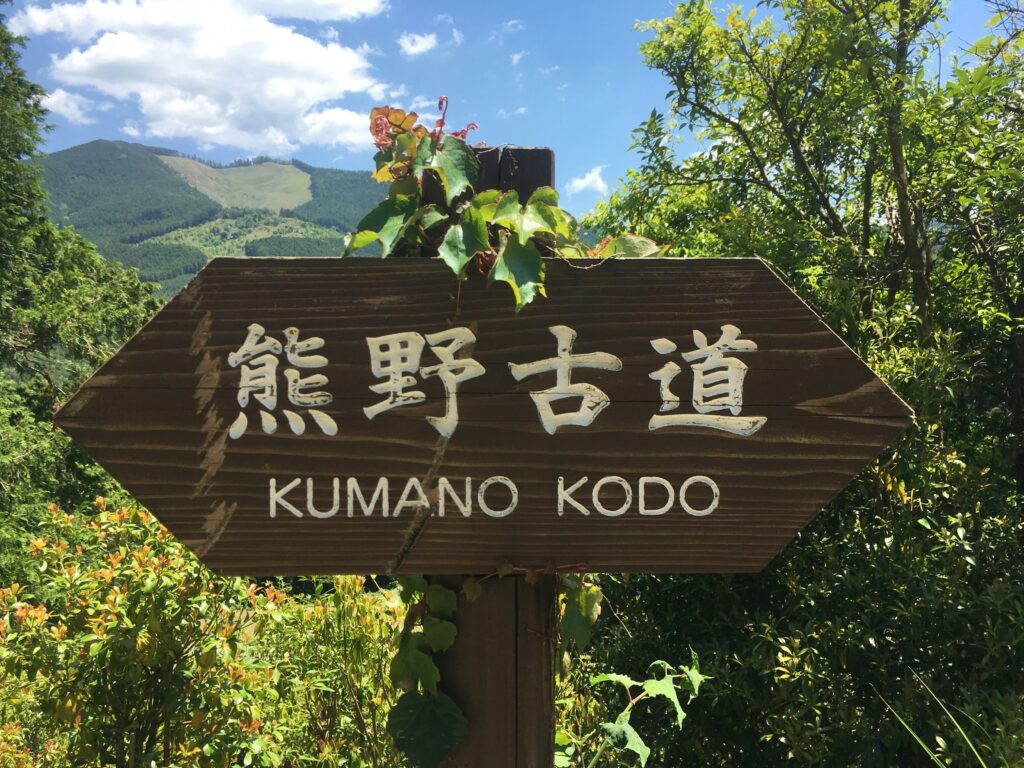
The route is punctuated by oji — small subsidiary shrines, once ninety-nine of them, where pilgrims stopped to pray and rest. Many are now little more than a clearing with a stone marker and a wooden shelter.
Each stamp point has a rubber stamp and ink pad in a small box. You carry a stamp book, obtained at Takijiri-oji or the tourist information centres, and stamp it as you pass.
The stamps become the structure of the walk. They mark distance in a way that a GPS track does not, and the book itself is the best souvenir of the trip.
The Completion Certificate
Collecting the required stamps and presenting the book at Hongu, Hayatama, or Nachi earns a completion certificate. The requirements vary by route and by how much of it you walk.
The Tanabe City Kumano Tourism Bureau publishes the current stamp requirements. Check before you go, because the qualifying combinations are specific and it is disappointing to find you missed one box by four hundred metres.
Dual Pilgrim Status
Since 2015 the Kumano Kodo and the Camino de Santiago have operated a joint recognition programme. Complete qualifying sections of both and you become a Dual Pilgrim, receive a pin, and have your name added to a register.
Among the walkers we meet on the Nakahechi, a meaningful proportion have walked the Camino and came here specifically for this. If you have a Compostela sitting at home, bring the evidence.
Starting at Takijiri-oji
Takijiri-oji is the practical trailhead for the Nakahechi and the point where the mountains formally begin. The information centre there has English maps, stamp books, current trail conditions, and staff who will tell you honestly whether the weather makes today a bad idea.
Buses run from Kii-Tanabe station in about forty minutes. Start early enough to reach Takahara or Chikatsuyu in daylight — this trail has no lighting of any kind.
Inns, Luggage, and Hot Springs
The accommodation system is the reason this walk is accessible to people who would never carry a tent, and it is the reason booking is the hardest part of the trip.
Kumano Travel and Village Minshuku
Kumano Travel, run by the Tanabe City Kumano Tourism Bureau, is the official booking platform and handles inns, luggage transfer, and bus tickets in English. It is a non-profit operation and it works well.
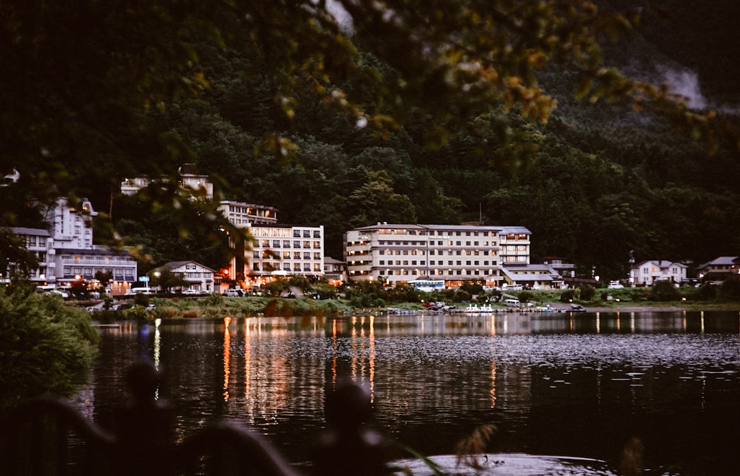
Most lodging on the Nakahechi is minshuku — family-run guesthouses with a handful of tatami rooms, a shared bath, and dinner and breakfast included. These are not hotels. Dinner is at a fixed time, the food is whatever the family cooks, and it is generally excellent.
Capacity is the constraint. A village on the Nakahechi may have four inns with six rooms each. That is the entire supply for that night, for everyone walking the route.
Book Six Months Ahead
For the peak months — April, May, October, November — six months ahead is not cautious, it is normal. Kumano Travel opens bookings well in advance and the good dates go.
Build the itinerary backwards from accommodation availability rather than deciding the walking days first. There is no alternative if the inn is full; the next village is a full day away.
If you are inside three months and finding nothing, look at booking through a specialist operator, who hold allocations. It costs more and it may be the only way.
Luggage Forwarding
Your main bag is collected from your inn each morning and delivered to the next one for a modest fee, arranged through Kumano Travel or the inn itself.
This changes the walk completely. You carry a daypack with water, snacks, a shell, and a camera, and the twenty kilometres becomes a pleasure rather than an endurance exercise.
Almost everyone uses it. There is no purist point being made by carrying a full pack over these passes.
Yunomine, Kawayu, and Watarase
Three onsen villages cluster near Hongu, and staying at one is the natural end to the walking days.
Yunomine is the oldest, a tight cluster of inns along a steaming stream, and the site of Tsuboyu. Kawayu is the strange one — the riverbed itself is geothermal, and you dig a hole in the gravel and sit in it. In winter a large communal bath is bulldozed into the river.
Watarase has the largest open-air baths of the three. All are within a short bus ride of Hongu.
Expert Tip
Buy food before you leave the village in the morning. There are no shops, no vending machines, and no restaurants on the trail sections — a stretch of the Nakahechi runs six hours between anything resembling a supply point. Inns will make you a packed lunch if you ask the night before, usually for around ¥800, and this is by far the easiest solution. Ask at check-in, not at breakfast.
Preparation and Season
This is a genuine mountain walk in a wet climate. Treat it accordingly and it is comfortable.
What the Walking Is Actually Like
Steep, uneven, and often slick. The surface alternates between forestry road, packed earth, exposed cedar roots, and old stone paving that becomes glassy in rain — and the Kii Peninsula is one of the wettest regions in Japan.
Ascents and descents are sustained rather than technical. There is no scrambling and no exposure. The difficulty is cumulative: five or six hours of continuous up and down, day after day.
If you walk regularly at home, you will be fine. If you do not, train on hills for two months first, and consider the two-day core Nakahechi rather than the full traverse.
Gear
Boots with ankle support and aggressive tread, not trail runners. Trekking poles, which save the knees on descents and are the item walkers most often wish they had brought. A proper waterproof shell, not a packable windbreaker.
Add a headtorch, a power bank, and cash. Rural inns and buses frequently do not take cards, and ATMs on the route are limited to post offices in the larger villages.
Bear bells are sold locally and worn by most Japanese walkers. Encounters are unlikely and the bells cost very little.
When to Go
Late March to May, and October to early December. Those months give mild temperatures, moderate rain, and the two visual peaks — cherry and fresh green in spring, colour in the maples in autumn.
June and July are the rainy season, with heavy rain, high humidity, leeches on wet sections, and a real risk of trail closures. August is hot enough to be genuinely unpleasant on the climbs.
Winter walking is possible on the lower Nakahechi and quiet in a way the other seasons are not, but the passes take snow and daylight is short. Check conditions with the Takijiri information centre before committing.
Kumano Kodo Trail: Frequently Asked Questions
Can I see the Kumano Kodo as a day trip?
Yes, and it is a reasonable compromise if you cannot give it four days. The most efficient day is the Nachi section: bus or train to Nachi, walk up the Daimon-zaka stone-paved slope through old cedars, reach Nachi Taisha and the waterfall, and return. That is roughly two hours of walking on the most photogenic stretch of the entire network. A second option is the Hosshinmon-oji to Hongu section, about seven kilometres and mostly downhill, which is the traditional final approach and ends at Oyunohara. Neither substitutes for the multi-day walk, but both are real.
How far ahead should I book accommodation?
Six months for April, May, October, and November. Three to four months for the shoulder periods. The bottleneck is absolute — the villages on the Nakahechi hold a few dozen beds between them, and when they are gone there is no overflow option within walking distance. Book the beds first and arrange your flights around them, not the other way round. Kumano Travel is the official platform and shows genuine live availability.
Is the trail well signed in English for solo walkers?
On the Nakahechi, yes, and unusually so for rural Japan. Signposts carry English, distances are marked in numbered posts every 500 metres, and the tourism bureau publishes good English maps. Solo walking here is straightforward and common. The Kohechi and Iseji are a different matter — signage thins, junctions become ambiguous, and mobile coverage disappears. Download offline maps regardless of route, tell your inn what time to expect you, and carry a paper map as backup.
Related Tours

Conclusion
Book the inns before you do anything else. Everything about a Kumano Kodo trip is negotiable except the beds, and travelers who plan the walking first and the lodging second usually end up not walking at all.
Then plan to finish at Yunomine rather than at a shrine. Reaching Hongu on foot and soaking in a wooden tub over a stream that pilgrims used for the same purpose eight hundred years ago is a better ending than any of the alternatives, and it costs a few hundred yen.
Plan Your Japan Trip with Local Experts
Our team has guided 40,000+ travelers across Japan. Tell us about your trip and we’ll get back to you within 24 hours.