In this article:
- Why Miyakojima Is Different From Okinawa’s Main Island
- Getting to Miyakojima and Getting Around
- The Coast: Beaches, Capes, and Bridges
- In the Water: Snorkeling, Yabiji, and Staying Safe
- Miyakojima: Frequently Asked Questions
Introduction
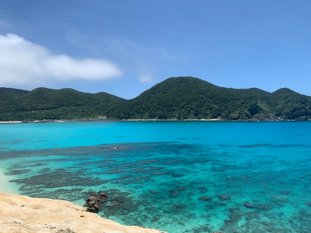
Drive onto the Irabu Bridge on a clear afternoon and the first thing you notice is that you can see the seabed. Not near the shore, but from the middle of a bridge several kilometres long, where the water should be deep and dark. On Miyakojima it is pale green over sand, then a sharp band of blue where the reef drops away.
That water is the reason to come. Miyakojima sits in the south of Okinawa Prefecture, a long flight from Tokyo and a short one from Naha, and most visitors to Okinawa never reach it. They stay on the main island, drive two hours to the aquarium, and go home. The travelers we work with who make the extra hop tend to describe it as a different trip altogether: quieter, flatter, slower, and organised almost entirely around the sea.
It is not an island of sights in the usual sense. There are no castles, few museums, and a handful of small towns. What it has is a coastline, a set of bridges linking it to four smaller islands, and a textile tradition that once paid the island’s taxes. The sections below cover how to reach it, how to move around, and how to plan a day so the light and the tide work in your favour.
Why Miyakojima Is Different From Okinawa’s Main Island
Okinawa’s main island is long, hilly, busy, and shaped by the American military presence. Miyakojima is none of those things.
A Flat Island With No Rivers
Miyakojima is essentially a raised coral reef. The land is low limestone plateau, covered in sugarcane, with no mountains to speak of and no rivers. That last point matters more than it sounds. With no rivers carrying soil and silt into the sea, the water around the island stays remarkably clear, and the colour visitors call Miyako blue comes from white sand under shallow, clean water.
The flatness also changes how the island feels from a car. You see the sea from most of the roads. On the main island, by contrast, the coast is often behind hotels, bases, or hills.
When to Go: Water, Wind, and Typhoons
The sea is warm enough for most swimmers from late spring into autumn, and at its warmest in high summer. That same period brings the risks. Typhoon season runs from roughly early summer into October, with July to September carrying the most risk, and a direct hit can cancel flights for a day or two.
Our preference is the shoulder months. Late April and early May, before the rainy season sets in, and October into early November once the peak typhoon period has passed, both give warm water, lighter crowds, and fewer cancelled flights. If you travel in August, build a spare day into the end of the trip rather than connecting tightly to an international departure.
Winter is mild on land but windy, and the north wind makes the sea rougher. It is a fine time to drive the island and see the capes. It is not the season for a snorkelling holiday.
Miyako Jofu and the Island’s Own Culture
Miyakojima was part of the Ryukyu Kingdom, and for centuries its people paid taxes to the Ryukyu court, which in turn owed tribute to the Satsuma domain. Much of that tax was paid in cloth. Miyako jofu is a fine fabric hand-woven from ramie thread and dyed with indigo, and the government designated it an Important Intangible Cultural Property in 1978.
A single bolt can take a weaver many months. Sitting at a loom for ten minutes, which the island’s traditional crafts centre lets you do, is the quickest way to understand why. It is one of the few indoor stops we include on a Miyakojima day, and guests who expected to skip it usually stay longer than planned.
The island also has its own dialect and its own drinking customs. At some local gatherings you may meet otori, a ritual in which awamori is passed around the table in turn after a short speech. If you are invited to join, a small sip each round is enough.
Getting to Miyakojima and Getting Around
Every visitor arrives by air or by cruise ship. There is no ferry from Naha.
Two Airports: Miyako and Shimojishima
Miyako Airport sits just outside Hirara, the main town, and handles most flights, including direct services from Tokyo Haneda and frequent connections from Naha. The flight from Naha takes around fifty minutes. From Tokyo, allow closer to three hours.
The second airport, Shimojishima, is on the small island of Shimoji at the far end of the Irabu Bridge. It mainly serves low-cost and a smaller number of domestic routes, and routes change by season. Check which airport your flight uses before booking a hotel, because the drive between them takes time, and the rental car counters are not interchangeable.
If you are combining Miyakojima with the main island, the simplest pattern is to fly into Naha, spend a few days there, and take the short flight across. Cruise passengers arrive at Hirara Port, which is close to the town centre.
Why You Need a Car (or a Driver)
Public transport on Miyakojima is minimal. A few bus routes exist, but they run infrequently and do not reach most of the beaches in a useful way. Taxis are available in Hirara but become expensive across a full day of coastal stops.
For most independent travelers the answer is a rental car. Roads are quiet, distances are short, and driving is on the left. Most visitors will need an International Driving Permit issued in their home country, and we cover the details in our guide to driving in Japan with a foreign licence.
That said, a car alone does not tell you which beach is sheltered today or when the reef at a given lookout shows its colour best. On our private Miyako Island tour, which starts from the Hirara Port terminal and runs for about six hours, the guide adjusts the order of stops around wind and tide rather than following a fixed route. That flexibility is most of the value on an island this dependent on the sea.
How Many Days to Stay
One full day covers the main island and the bridges at a brisk pace. Three to four days is what we recommend. It allows one day for driving the coast, one for the water, and a spare day for weather, which on a subtropical island in summer is not optional.
Five days or more makes sense if you want a boat trip to Yabiji, several unhurried beach days, or a stay at one of the newer resorts. Rosewood Miyakojima, which opened in 2025 on the north coast, has shifted the island’s upper end noticeably, and it is the kind of place where guests plan fewer outings rather than more.
Expert Tip
Sort out cash in Hirara before you set off. Entrance fees, small restaurants, and craft workshops outside town are often cash only, and there is little to buy along the coast roads. Carry water, a hat, and swimwear in the car as a matter of routine, because the best swim of the day is rarely the one you planned.
The Coast: Beaches, Capes, and Bridges
Most of what you will do on Miyakojima is drive a few kilometres, stop, walk to the water, and look. The order matters more than the list.
Yonaha Maehama and Sunayama
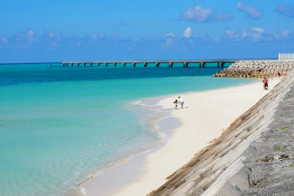
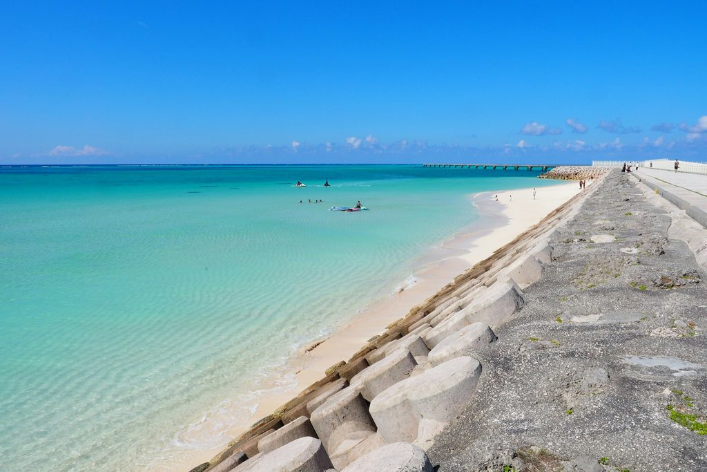
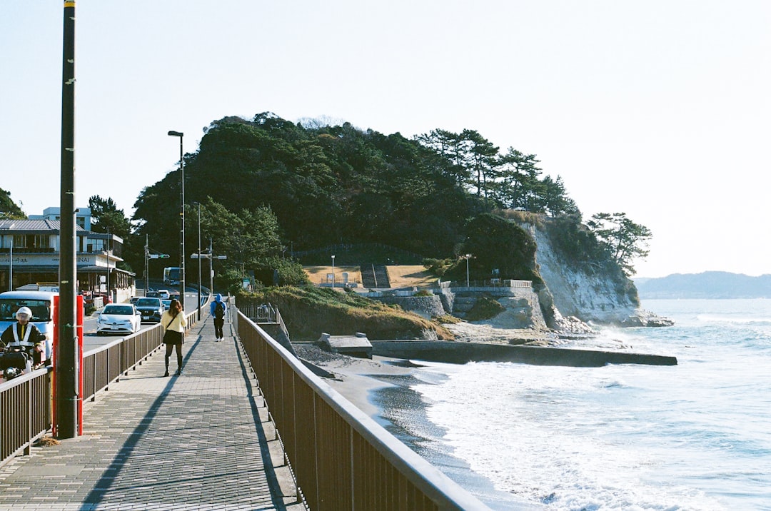
Yonaha Maehama runs for around seven kilometres along the south-west coast, facing the small island of Kurima. The sand is fine and very white, and the shallow water extends a long way out. It is the beach on most postcards of the island, and in our view it deserves the reputation. Go in the morning, when the sun is behind you and the colour of the water is at its strongest.
Sunayama, north of Hirara, is a smaller beach reached by walking over a sand dune. It is known for a rock arch at the water’s edge. In recent years the area around the arch has been fenced off because of rockfall risk, so you can photograph it but not walk through it. The beach itself remains open and is at its best in the late afternoon.
Higashi-hennazaki and the East Coast
Higashi-hennazaki is a narrow limestone headland about two kilometres long at the island’s south-eastern tip, with a lighthouse at the end and a path running out along the spine. On one side is the Pacific, on the other the East China Sea. The wind here is constant, and the cape feels far more exposed than anywhere else on the island.
Spring brings wildflowers over the grassland along the cape. At any time of year, we suggest walking the full length rather than stopping at the car park viewpoint. The last few hundred metres are where the sense of standing on the edge of the island arrives.
Irabu, Shimoji, Ikema, and Kurima Across the Bridges
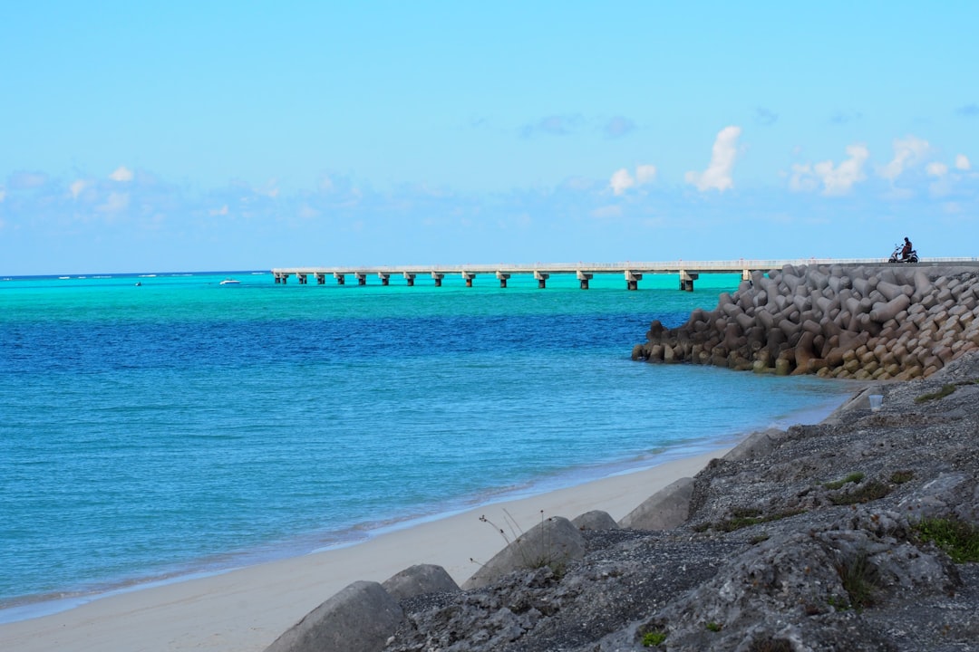
Three toll-free bridges link Miyakojima to its neighbours. The Irabu Bridge, opened in January 2015, runs 3,540 metres to Irabu Island and is the longest toll-free bridge in Japan. The Kurima Bridge reaches Kurima Island in the south-west at 1,690 metres, and the Ikema Bridge crosses to Ikema Island in the north at 1,425 metres.
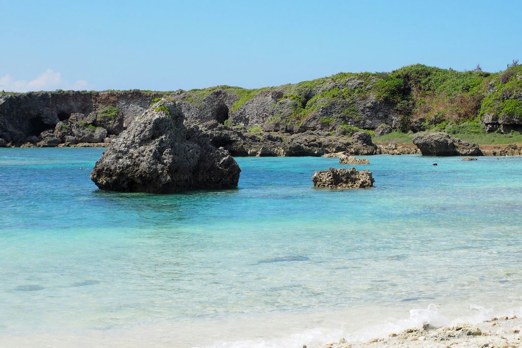
Irabu is joined to Shimoji by short crossings over narrow channels, so one drive covers both. This is where the island is at its most dramatic. Sawada-no-hama is a shallow bay scattered with large boulders said to have been carried ashore by a historic tsunami, and it faces west for the sunset. Toguchi-no-hama is a wide arc of white sand. On Shimoji, the area known as 17END sits at the end of the airport runway, where the reef flat shows extraordinary colour at low tide.
Toriike, also on Shimoji, is a pair of inland ponds connected to the sea underground. It is a well-known cave diving site, but even from the path above, the stillness of the water is unsettling in a way the beaches are not.
Painagama and Ending the Day in Hirara
Painagama Beach is a small beach within walking distance of central Hirara and the port. It is where islanders come after work, and it is not a resort beach in any sense. We end our Miyako tours here, and at the Ryugujo lookout over the reef coast if time allows, because both are at their best in the last hour of light.
Hirara itself is the only real town on the island. It is the place for dinner, for a bowl of Miyako soba, and for the small izakaya where the island’s evenings actually happen.
Expert Tip
Check the tide table before you plan the bridge day. The shallow reef flats around Shimoji and Irabu change colour dramatically between high and low water, and the difference at a spot like 17END can be the difference between a pleasant view and the one you came for. Low tide in the middle of the day gives the brightest result.
In the Water: Snorkeling, Yabiji, and Staying Safe
You do not need to dive to see the reef on Miyakojima. Several beaches have coral within a short swim of the sand.
Shore Snorkeling at Aragusuku, Yoshino, and Imgya
Aragusuku and Yoshino, on the south-east coast, are the two beaches most often recommended for shore snorkelling, and sea turtles are regularly seen near Aragusuku. Both get busy in summer. Arrive early, and take reef-safe sunscreen and water shoes.
Imgya Marine Garden, on the south coast, is a sheltered inlet with calm water and a walking path around it. It suits children and less confident swimmers better than the open beaches do.
If you have already snorkelled around Okinawa’s main island, the comparison is instructive. Our Okinawa snorkeling guide covers the Kerama Islands and the Blue Cave, and on a calm day the visibility at Miyakojima holds up well against both.
Yabiji by Boat
Yabiji is a large group of coral reefs roughly fifteen kilometres off the north of the island, beyond Ikema, and it is often described as the largest reef complex in Japan. Parts of it rise close to the surface at the lowest spring tides, and the snorkelling there is on a different scale from the shore beaches.
It can only be reached by boat, and trips depend heavily on weather and sea state. Book with an established local operator, expect cancellations in wind, and treat it as a bonus rather than the fixed centrepiece of a short stay.
Habu Jellyfish and Netted Beaches
Okinawa Prefecture issues a habu jellyfish advisory each summer, typically from June to September. The habu jellyfish is a box jellyfish whose sting is painful and can be dangerous.
In practice, swim at managed beaches with jellyfish nets during this period, wear a rash guard, and follow lifeguard instructions. The prefecture’s recommended first aid is to pour vinegar over the sting before removing any tentacles. Outside the netted areas, and especially at quiet beaches with no lifeguard, we suggest more caution than the calm water might suggest.
Miyakojima: Frequently Asked Questions
How do you get to Miyakojima from Tokyo or Naha?
By air. Miyako Airport has direct flights from Tokyo Haneda and frequent flights from Naha, and Shimojishima Airport handles additional routes that change by season. The flight from Naha takes around fifty minutes. There is no passenger ferry from the main island, so if you are already in Okinawa, flying is the only practical option.
Can you see Miyakojima without renting a car?
Only partly. Buses are infrequent and do not serve most of the beaches, so without a car you are limited to Hirara and whatever taxis can reach within your budget. The alternatives are a private driver-guide for a day or a resort that runs its own transfers. For travelers who do not want to drive on the left, a guided day early in the stay is the most efficient way to see the coast.
When is the best time to visit Miyakojima?
For swimming, late spring through early autumn. For the best balance of warm water, lighter crowds, and lower typhoon risk, we suggest late April to early May, or October into early November. July to September has the warmest sea but also the highest chance of typhoons and the peak jellyfish season, so leave spare days in the plan. For more on how the month shapes a Japan trip, see our guide to visiting Japan in September.
Related Tours
Conclusion
Miyakojima is not a place to tick off in an afternoon between flights. The island’s appeal is in the water and the light, and both change with the tide, the wind, and the hour. Give it three or four days, and treat the weather as part of the itinerary rather than a threat to it.
The practical order is simple. Book flights with a spare day at the end, especially between July and September. Arrange a car or a driver before you land, carry cash, and check the tide before the bridge day. Then start early at Maehama, spend the middle of the day on the reef flats around Shimoji, and finish at Painagama as the sun goes down.
Plan Your Japan Trip with Local Experts
Our team has guided 40,000+ travelers across Japan. Tell us about your trip and we’ll get back to you within 24 hours.